
Field data for utility inspectors, wetland scientists, geotechnical crews, foresters, ecologists, archaeologists and paleontologists
The whole field workflow.One product.
Set up, collect, QA, report, deliver — without moving data between apps.


- Start from the form you already use.
- Collect on iPad — no signal needed.
- QA on the web before you demobilize.
- Delivery-ready report, same day.
01The problem
One survey shouldn’t need six apps.
Nobody chose that stack. It accumulated, one tool at a time.
Every seam between them is a manual handoff, and a place data goes wrong.
02 / Set up
Build it once. Run it every project.
A Composition packages the schema, map symbology, and report templates into one reusable template.
Elsewhere this is a services engagement.
01 Design it once: the project, its assets, their inspections02 Every new project starts from the same Composition03 Open a project and collect: records on the map and in the list, as one hierarchy
03 / Collect
Real relationships. Not repeated rows.
Assets hold inspections. Inspections hold defects and photos. Every record rolls up the chain.
Form builders give you repeats inside one form. That is not a data model.
“What took me days, weeks now takes literally seconds.”


04 / Collect
Offline. And offline together.
Crews with no signal split the work and see each other's records live, device to device.
Most apps mean work alone, sync at the truck.
01 No signal: every record crosses device to device02 One tablet finds signal and uploads the whole crew's work03 Photos, GIS, the form: three people on one record, live
05 / QA
Catch it before you demobilize.
Data tables on the device, and rules that reject bad values as they're typed.
Map-first apps don't put a table in your hand.
06 / Deliver
Report and export, same day.
Collect it once. The data form, the sample point log, the GIS layers and the photos all come from the same records.
Your GIS stays your GIS. We're where the data is born.
07 / The details
The small things that save a field day.
 Mobile + Web
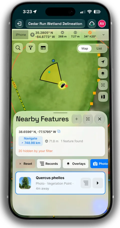
Photos on the map
Every photo lands where it was taken, with the direction it faced. Browse a site by where, not by filename.
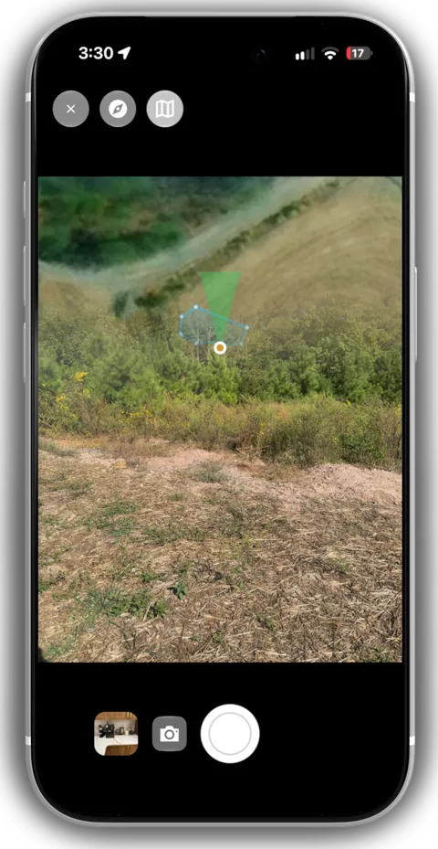 Mobile
A camera that knows where it's pointing
Heading and a heading-up mini map right in the viewfinder, so every photo carries its direction.
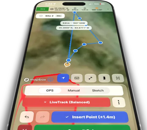 Mobile
LiveTrack
Walk the boundary or the transect. The line draws itself as you go, with GPS accuracy on every point.
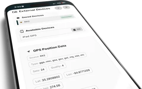 Mobile
Bring your GNSS receiver
Pair a Bluetooth receiver. Satellites, fix quality and raw NMEA ride along into every export.
 Mobile
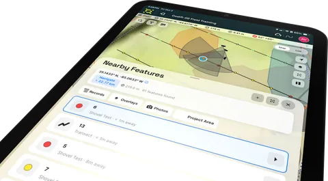
Nearby features
What's around you right now: the closest records, overlays and photos, with distance and direction.
 Mobile
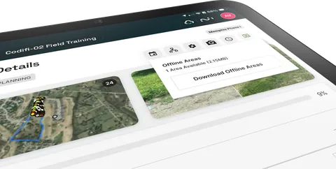
Offline map areas
Download the project area's basemaps and imagery before you lose signal.
 Mobile + Web
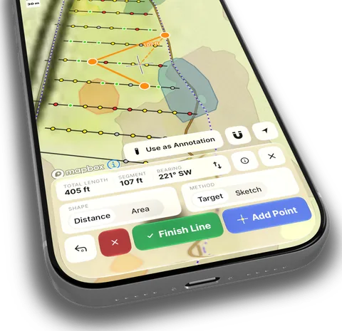
Measure anything
Distances, areas and bearings on the live map, and keep any measurement as an annotation.
 Mobile + Web
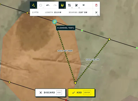
Magnetic snapping
Vertices land exactly on the feature you mean, and Codifi tells you which one by name.
 Mobile + Web
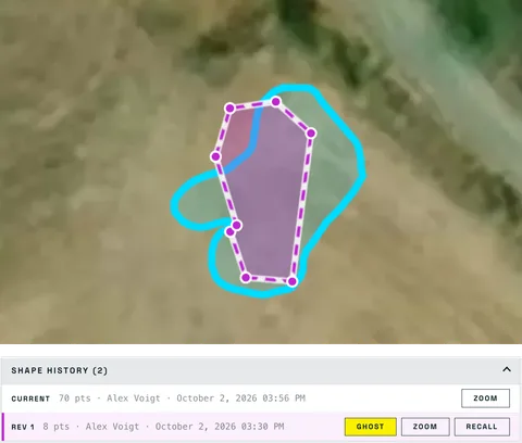
Shape history and recall
Every shape a location has had, with who changed it and when. Ghost an old one, or recall it.
 Web
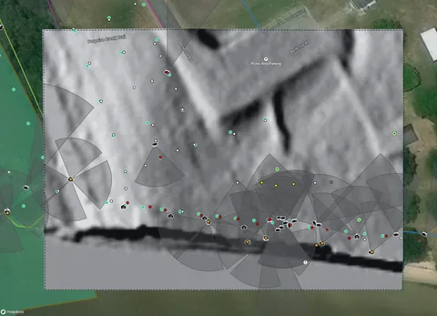
WebImagery on demand
Hillshade, local relief, slope and historic imagery for any extent, kept as a layer and taken offline.
 Mobile + Web
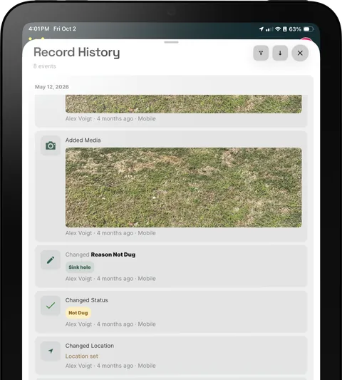
Record history
Who changed what, and when, on every record. Review it before anything ships.


Who built it
Built in the field, with field crews.
Codifi came out of cultural resource management and archaeology — deep record hierarchies, federal deliverables, and a long way from a cell tower. If it survives a Section 106 deliverable, it will survive your inspection form.

09 / News
Get in touch.
Codifi is being liquidated as part of Chronicle Heritage.
While the product is no longer available to customers, the team who built it is.
Three of us built it.
All three of us designed, engineered and shipped. Each of us led a different part of it.

Alex Voigt
Head of Product
- Product
- Design
- Engineering
Led the product from the first sketch to a company-wide rollout, designed it and its design system, and wrote most of what you touch in it.

Hugo Bounoua
Solutions architect
- Engineering
- Design
Architected Hydra, the sync engine, and Ripple, the formula engine, and built much of the backend underneath them. Designed parts of the product too.

Jonathan Sims
Project manager
- Project management
- Design
- Engineering
Ran the projects, regression testing and QA, and the log of what users asked for, so each release started from what crews needed. Designed and built parts of the product too.


